We have lift-off – satellites and agri risk management
On 3 January 2023, the first of seven optical satellites were sent into a low Earth orbit from a Falcon 9 rocket operated by Elon Musk’s Space X company. Blasting off from Cape Canaveral Space Force Station in Florida, the creators of the EOS SAT say it was the first time an agriculture-focussed satellite constellation had been launched by a remote sensing company.
The constellation consists of seven small, 178kg satellites that provide panchromatic (captures all visible colours) and multispectral (captures data from different light bands) high-resolution imagery. The first satellite (EOS SAT-1) can provide farmers, including in Australia, with insights including vegetation indices, data on field productivity and weather forecasts, according to EOS Data Analytics (EOSDA).
The satellites use a set of agri-related bands aimed specifically at farm area monitoring, with high-tech sensors providing higher resolution photos, introducing better coverage of the land, and tracking changes in the air, vegetation, soil and water. EOS SAT-1 monitors up to one million square kilometres daily. By 2025, the constellation will monitor up to 12 million square kilometres daily and cover approximately 98.5% of the globe’s farming and forestry land.
Beyond providing valuable data for farmers, the company believes the insurance industry will also benefit.
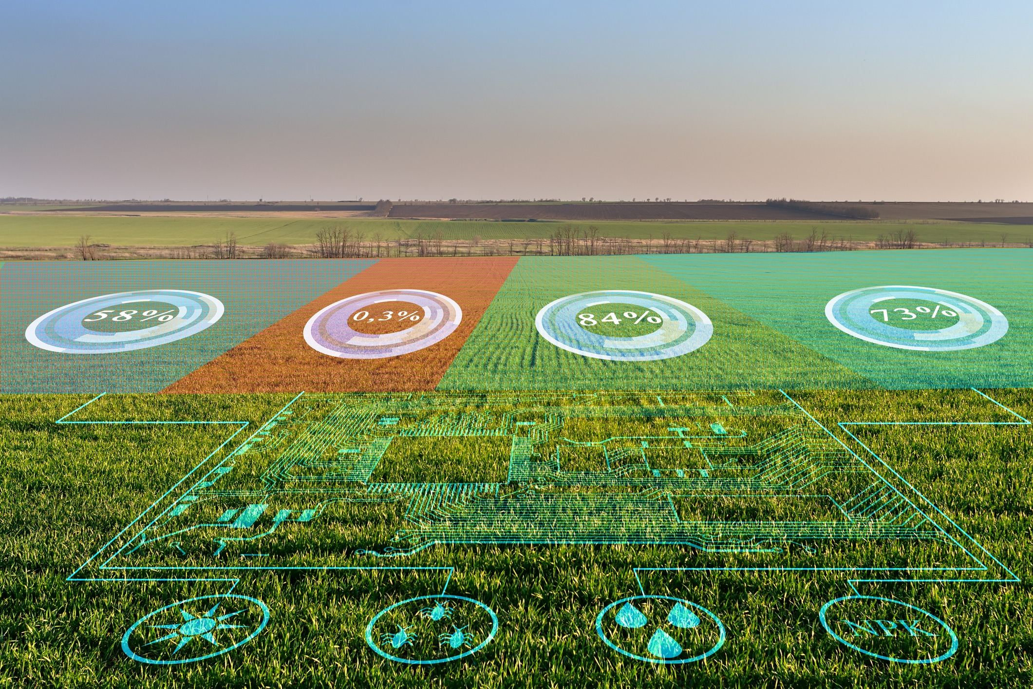
Satellites and farming
Precision farming, or precision agriculture (PA), has been an expanding area of technology since the 1990s. It involves using technology such as GPS, robots, drones and sensors to increase knowledge and efficiency in agricultural practices. More recently, the focus has been on using satellites.
At a vantage point of up to 36,000km above the planet’s surface, satellites can observe vast tracts of farmland and provide insights that are harder to grasp from ground level. Remote-sensing satellites can provide key data for monitoring soil, crop development, livestock movements and weather, helping farmers to make more efficient and productive choices. For example, rainfall assessments from satellites help farmers plan the timing and amount of irrigation they will need for their crops, notes the UN Office for Outer Space Affairs.
The Global Center on Adaption says satellites can support farmers in three key ways:
- Mapping – understanding how large areas of land are used for different types of agriculture
- Measuring – plugging satellite data into complex algorithms to provide measurements on a range of properties, such as yield and crop growth stage
- Monitoring – over time, images enable scientists and farmers to see how land use has developed, or identify changes in rainfall and drought patterns.
The University of Sydney’s Precision Agriculture Laboratory was established in 2012 and calls PA “a revolution in agriculture brought about by the application of information technology”. It is believed that PA can minimise the costs of water, seeds, feed, fertiliser and fuel, and lower agriculture’s dependence on weather conditions.
In a media release issued following the launch, EOSDA said EOS SAT will assist agribusiness in monitoring crop growth and detecting heat, cold, water stress, weed spread, pest attacks, and other issues threatening crops. Farming customers will also be able to optimise their input use based on productivity and vegetation maps provided by the constellation, test the effectiveness of new crop protection products or fertilisers, avoid unnecessary field inspections and “thus reduce fuel use, manage irrigation, estimate yields, and more”.
Suppliers are tapping into the tech too. For example, there are fertiliser suppliers that use satellite data to drive their apps which help farmers make decisions about how much fertiliser to use on their paddocks and how to distribute it – improving efficiency, saving costs and reducing the amount of fertiliser used, which is good for the environment.
Streamlining insurance in the ag sector
Satellites can provide insurers with precise, actionable data too. Globally, crop insurers are using satellite services to streamline processes. Benefits are said to include:
- improved safety and flexibility – no need to send people into the field, the information is captured remotely by satellites and reported back to the crop insurer
- cost savings/reduced overheads – insights can be used to automate policy data capture, validate loss assessment and handle claims cost-effectively (timely insights can be provided about the type of crop, planting dates, prevented planting, crop damage, harvest dates and other crop key performance indicators)
- increased speed of payout – validating and paying out claims faster, improving customer satisfaction and reducing churn
- more robust loss prevention – timely insights on crop development can enable early alerting and mitigation of problems during the crop life cycle
- potential for new insurance products – more granular insights can facilitate better parametric insurance.
ESODA say that the hard data that the satellites will provide can facilitate easier claims processing, particularly by automating and streamlining workflows. The satellite information will also allow close tracking of crop performance and enable smarter management of payout risks by rating farmers’ fields according to historical data. In addition, the satellite data can help farmers prove their eligibility for crop insurance programs and support any insurance claims.
As the use of PA and satellite data expands within the ag sector, the technology may not only facilitate better risk management but support the transition to a more sustainable future for agriculture. Access to accurate data and insights on climate change, soil and water quality, yield prediction and more, may help agriculture-related businesses reduce CO2 emissions, cut energy consumption, decrease water usage, use fertilisers wisely and manage farms better.
For agriculture insurance covers, talk to your EBM Account Manager.
